How NASA Is Homing in From Space on Ocean debris
NASA's Eye In The Sky: Shocking Ocean Debris Disco...
The fight against ocean plastic just got a potentially huge boost, and it's coming from, well, space. NASA is leveraging its Earth-orbiting technology to track plastic and other debris polluting our seas. It’s a pretty ingenious approach, using the unique "fingerprints" of different materials to identify them from hundreds of miles above.
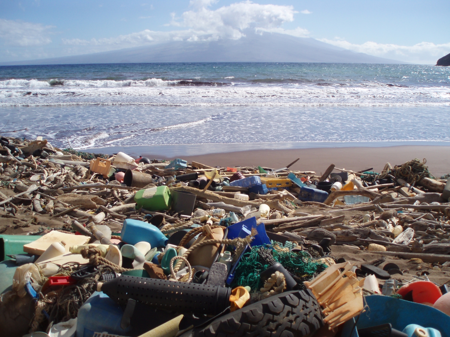
Remember that breakthrough announcement in late 2025? NASA's Earth Surface Mineral Dust Source Investigation (EMIT) sensor, which is mounted on the International Space Station, managed to detect concentrated plastic pollution on land. That got marine researchers thinking: could this same tech be used to track all sorts of floating junk in our oceans? Think about it – detergent bottles, discarded fishing gear, all that stuff can travel thousands of miles, eventually washing up on even the most remote islands, like Kaho’olawe in Hawaii. I've seen it firsthand; it's heartbreaking.
But spotting plastic in the ocean is a whole different ballgame compared to finding it on land. Seawater throws a wrench in the works, absorbing infrared light and making it harder to pick up the specific spectral signals that identify different materials. This is where some serious groundwork is needed before we can effectively deploy these advanced sensors.
Enter Ashley Ohall, a NASA intern who, along with other researchers, has put together a groundbreaking reference library. This isn't your average library; it's a collection of nearly 25,000 molecular "fingerprints" from all sorts of flotsam and jetsam. We're talking rope, tires, metal, bubble wrap, buoys, even those ubiquitous bottle caps. And because plastic is such a major component of marine debris, the library includes spectral data for about 19 different types of polymers. That's a seriously comprehensive database!
EMIT, launched back in 2022, was originally designed to map minerals and their impact on the atmosphere. But here's the cool part: its data is proving incredibly versatile, with applications popping up in fields like agriculture and even water science. Who knew it could also become a key tool in the fight against ocean pollution?
Here's the reality: it's estimated that 8 million tons (or more!) of plastic end up in the ocean every single year, and most of it comes from land. Mapping those pollution hotspots near coastlines could be a game-changer, allowing us to target our efforts and reduce the amount of debris that ends up on our beaches and in the open sea. It’s a vital first step, and the fact that EMIT can do this, even though it wasn't its primary mission, is just incredible.
So how does EMIT do it? This sensor, orbiting high above us, analyzes the unique spectral patterns that different compounds create when they reflect sunlight. It's a technique called imaging spectroscopy, pioneered at NASA’s Jet Propulsion Laboratory (JPL) right here in Southern California. Pretty impressive stuff, and it’s being used on missions throughout the solar system – and now, hopefully, to clean up our oceans.
David Thompson of JPL, a co-author of the 2025 study, pointed out that the same tech has also been used to detect plastic compounds in landfills and even large-scale structures like greenhouses. The challenge, as he explained, lies in overcoming the interference from seawater. But thanks to the hard work of Ashley Ohall and her collaborators, compiling this open-source library of data from numerous researchers, we're one big step closer to making it happen.
Comments
Please sign in with Google to post a comment
No comments yet. Be the first to comment!