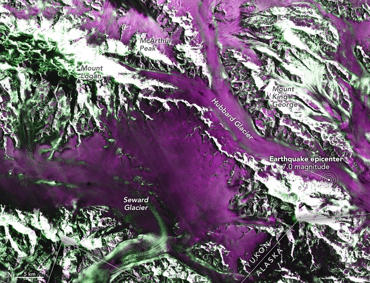
Mother Nature reminded us of her raw power just last week. A significant magnitude 7.0 Earthquake rattled the remote St. Elias Mountains, a stunning yet unforgiving landscape straddling the Yukon-Alaska border. And when the earth moves that violently, things *move*. In this case, a lot of ice and rock from Hubbard Glacier decided to take a tumble.
Hubbard Glacier SHOCK! Landslide Avalanche Creates...
The initial reports paint a dramatic picture. The quake struck on December 6th, and almost immediately, the steep slopes around Hubbard Glacier gave way. Imagine the force required to dislodge massive chunks of ice and rock – it’s a chilling thought, literally and figuratively.
Luckily, the folks at NASA and ISRO (Indian Space Research Organisation) were on the case. The NISAR satellite, equipped with some seriously impressive radar technology, was able to capture images of the affected area shortly after the event. These aren't your typical pretty pictures, mind you. They're radar images that help scientists see how the terrain has changed. And what they revealed was pretty striking.
Now, here's where it gets a little technical, but stick with me. Typically, after an Earthquake, geophysicists like Eric Fielding at NASA's Jet Propulsion Laboratory (JPL) use satellite data to map ground displacement. They create "interferograms" that show how the earth has shifted. But the problem here is that this area is covered by a ridiculously thick layer of glacial ice – we’re talking over 2,000 feet thick! As Fielding put it, "The cryosphere is covering up the geosphere."
So, instead of looking for ground displacement directly, the scientists had to get a little creative. They focused on the debris – the rock, snow, and ice that had been swept down onto the glacier's surface by landslides and avalanches. Comparing radar images from before and after the earthquake revealed a clear increase in rough terrain, indicating where these slides had deposited their icy loads. Think of it like a giant, albeit dangerous, snow globe that someone just shook up.
It's a good reminder of the dynamic forces constantly shaping our planet. While devastating, these events also offer valuable insights into the earth's processes. Plus, it highlights the importance of having sophisticated tools like NISAR in orbit, allowing us to monitor even the most remote corners of the world. And frankly, seeing these images makes you appreciate the sheer power of nature, even if you are just viewing it from the safety of your desk.
Comments
Please sign in with Google to post a comment
No comments yet. Be the first to comment!