Chesapeake Bay Locked in Ice: A Look Back at the Big Freeze of '77
Chesapeake Bay Frozen Solid! What This Means For W...
The Mid-Atlantic region just endured a tough winter, and while the partially frozen Chesapeake Bay made headlines, veteran locals might remember an even more extreme event from nearly half a century ago. I'm talking about the winter of 1976-1977, when the Bay was almost entirely ice-locked. It's a stark contrast to what we saw this year, and worth remembering just how dramatically weather can shift.
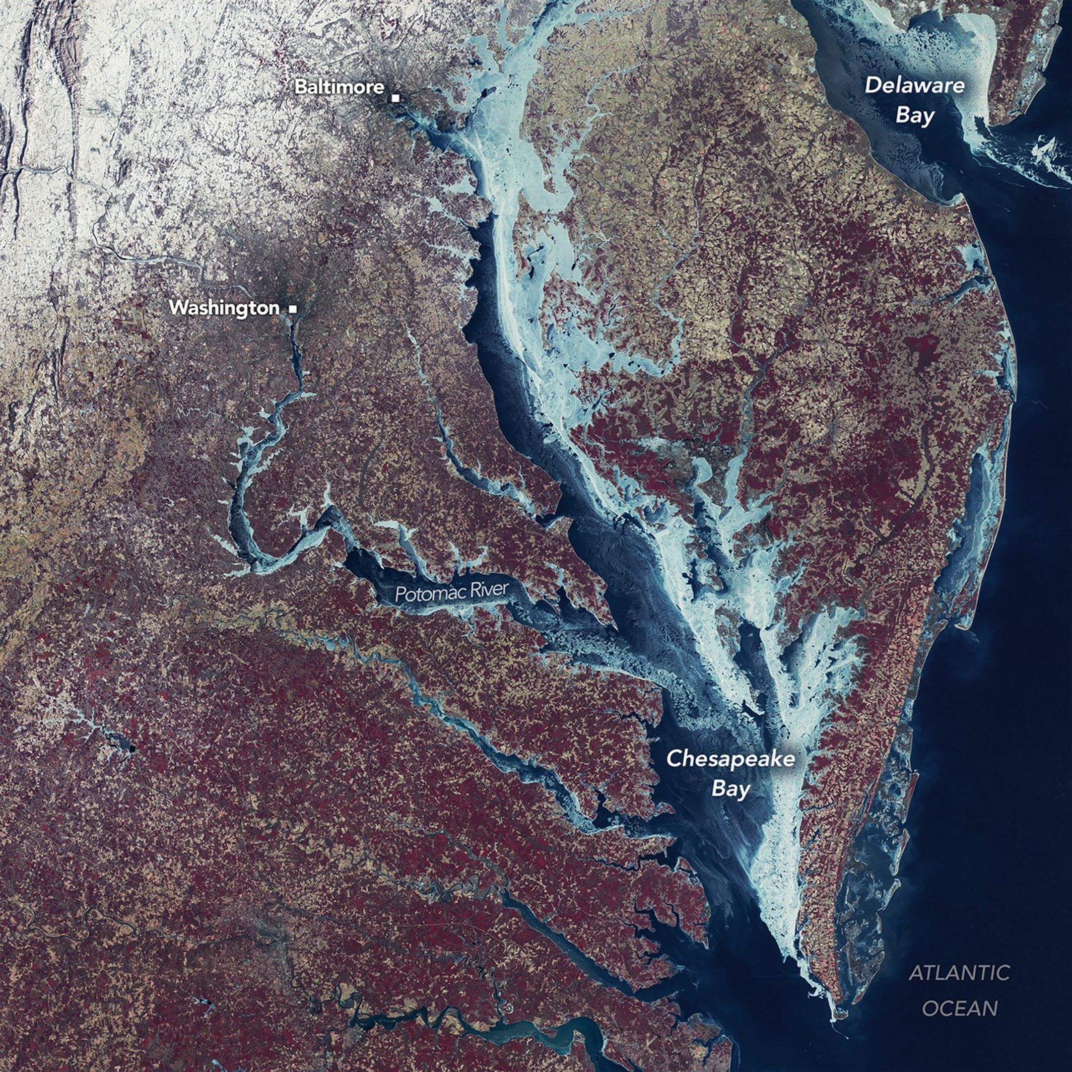
Back then, Landsat 1, a marvel of its time, captured an incredible image of the frozen landscape. The satellite's Multispectral Scanner System (MSS) snapped a mosaic, pieced together from scenes on February 7th and 8th. Using false color – blue, green, and white for ice – the image revealed an almost unbelievable scene. Snow blazed white, vegetation appeared red, and urban areas were muted brown-gray. It's a beautiful, if somewhat alarming, picture of a region in deep freeze.
NASA analysts dove into these Landsat images, and others, to understand the ice's behavior. Their 1980 study revealed that ice started forming way back in late December 1976, creeping down from the Chesapeake's tributaries. By mid-January, the upper bay was iced over. And then, in early February – around the time that stunning Landsat image was captured – a whopping 85% of the Chesapeake Bay was covered in ice, reaching its peak extent.
Imagine the scene. Relentless westerly winds at the beginning of February slammed that ice sheet against the eastern shores of the Chesapeake and Delaware bays. This created huge fractures, visible even from space. Once the winds calmed, new, thinner ice started to form in the open patches, appearing as darker blue swathes in the satellite imagery. I've seen similar patterns on smaller, frozen ponds, but to see it on this scale is truly remarkable.
Icebreaking reports from the time paint an even grimmer picture. Up in the upper bay, the ice was a solid 30 centimeters (12 inches) thick! Down in the lower bay, it was still a formidable 20 centimeters (8 inches). And in some of the tributaries? Double that. Stories abound of people ice skating off Kent Island, right in front of the Bay Bridge. Some even drove cars and tractors across the frozen expanse. Can you imagine that today?
But this wasn't just a winter wonderland. The deep freeze had a devastating impact. Shellfish populations suffered massive die-offs from the ice and frigid water. The sheer weight of the shifting ice crushed piers, marinas, and even lighthouses. It was a costly winter, no doubt. The recent freeze of 2025-2026, while impactful to watermen, simply doesn't compare. We saw some ice boating on Claiborne Cove, but nothing approaching the scope of '77. It's a powerful reminder of the potential for extreme weather and its consequences.
Comments
Please sign in with Google to post a comment
No comments yet. Be the first to comment!